Lab 6:
For this lab, I chose to do a model of where I'm from - the SF Bay Area (specifically Berkeley). The section of map I downloaded shows all the most important parts of the Bay Area: San Francisco, Marin, Oakland, Richmond, Berkeley, Palo Alto, Orinda, etc. (You can see Berkeley, because it's right where that long pier is sticking out of on the East side of the Bay). The scale of my map is 1: 441,754, which is a really weird number. I wasn't really paying attention to the scale except to make sure that it was within the parameters of the assignment, otherwise I would have made it into a nicer, round number. The exact parameters of my grid in decimal degrees, starting with the Northwest corner and rotating clockwise is:
(38.096°N, -122.727°W)
(38.096°N, -121.992°W)
(37.591°N, -121.992°W)
(37.591°N, -122.727°W)
Spacial reference: GCS North American 1983
Datum: North American 1983
And without further ado, the maps:
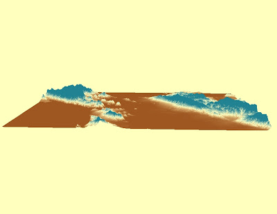
Now the 3D rendering of the model, in a few different views:
an "at eye level" view:
and one more...


No comments:
Post a Comment